Shanghai is not one city so much as a dozen cities stitched together by a river and a metro map. The 1920s bank palaces of the Bund, the walled Ming-dynasty Old City ten minutes’ walk south, the plane-tree lanes of the former French Concession, the glass towers of Lujiazui across the water, and the canal town of Zhujiajiao an hour west all sit inside the same municipal boundary, and they could not feel more different. This Shanghai districts guide explains how the city is laid out, what each area is actually for, how the areas connect by metro, and which one you should base yourself in, so that you can plan a trip by geography rather than by a list of attractions scattered across 6,340 square kilometres.
Two things trip up most first-time visitors. The first is scale: Shanghai has 16 administrative districts and roughly 24.8 million residents according to the Shanghai Municipal Government, and the tourist core is a small slice of that. The second is that the names people use (“the French Concession”, “the Old City”, “the Bund”) are not administrative districts at all. They are neighbourhoods that straddle official lines. This guide uses the names travellers use, and tells you which official district you are standing in when it matters, which is mostly for hotel searches and taxi drivers.
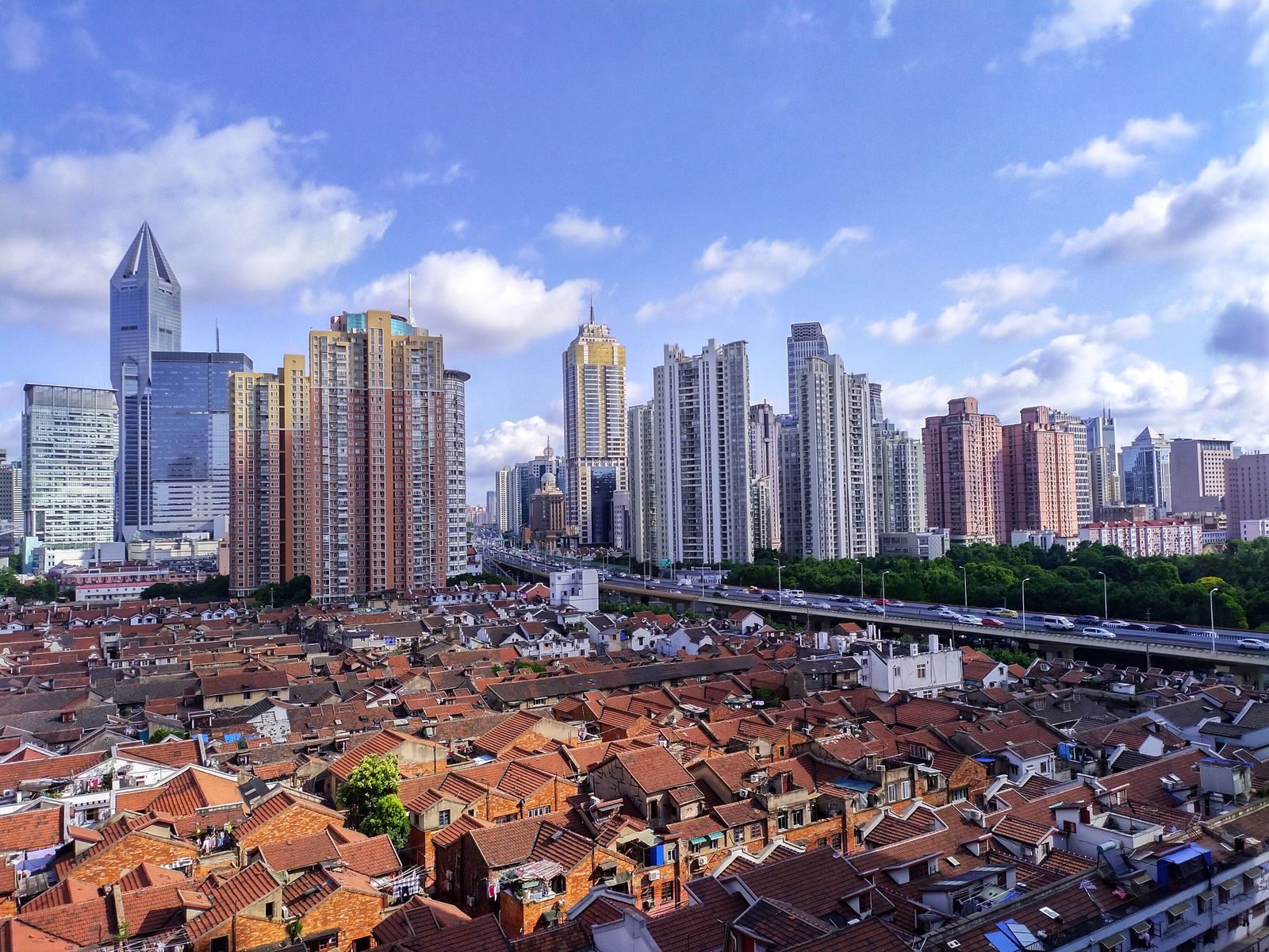
Table of Contents
- How Shanghai Is Laid Out: Puxi, Pudong and the Ring Roads
- The 16 Districts of Shanghai (and Which Ones Matter to Visitors)
- Shanghai Districts at a Glance: Comparison Table
- The Bund and Nanjing Road East (Huangpu)
- People’s Square and Nanjing Road West
- The Old City: Yu Garden and Nanshi
- The Former French Concession: Xintiandi, Tianzifang, Wukang Road
- Jing’an: Temple, Malls and the Best-Connected Base
- Lujiazui and Pudong: The Skyline Side of the River
- Hongkou and the North Bund
- Xuhui and the West Bund Museum Mile
- Suzhou Creek, M50 and Putuo
- Outer Shanghai: Hongqiao, Qibao, Zhujiajiao, Songjiang and Disneyland
- Getting Between Shanghai Districts: Metro, Ferry and Tunnel
- Which District Should You Stay In?
- A District-by-District Plan for Three Days
- Mistakes First-Timers Make With Shanghai’s Geography
- Frequently Asked Questions
How Shanghai Is Laid Out: Puxi, Pudong and the Ring Roads
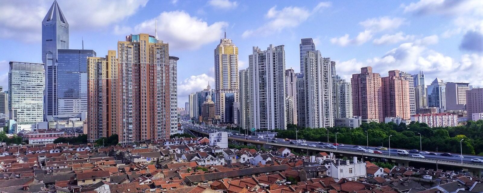
Everything starts with the Huangpu River, which snakes north through the city before emptying into the Yangtze. The west bank is Puxi (“west of the Pu”), the historic city where almost everything built before 1990 stands: the Bund, the Old City, the former concessions, the temples, the lane houses and most of the restaurants you will want to eat in. The east bank is Pudong (“east of the Pu”), which was farmland and docks until the central government designated it a special development zone in 1990. Three and a half decades later it holds the Oriental Pearl Tower, the Shanghai Tower, the international airport, Disneyland and the free Shanghai Museum East. The two halves face each other across a 400-metre stretch of water at the Bund, and that face-off is the single most photographed view in China.
The second concept worth knowing is the ring roads. The Inner Ring is a 48-kilometre elevated loop that encloses the old core on both banks; nearly every neighbourhood in this Shanghai districts guide sits inside it, and if a hotel listing says “inside the Inner Ring” it means genuinely central. The Middle Ring and Outer Ring lie progressively further out and enclose the newer residential belts; Hongqiao’s transport hub and the West Bund museums sit roughly between the inner and middle rings, while Qibao, Disneyland and the water towns are beyond the outer one. As a rule, anything inside the Inner Ring is reachable from the Bund in 25 minutes by metro, and anything beyond the Outer Ring is a half-day commitment.
Shanghai Metro is the glue. With around 20 lines and more than 500 stations as of 2026, it is the longest urban rail network in the world, and fares run from ¥3 to ¥15 by distance. Foreigners can now tap a contactless Visa or Mastercard directly at the turnstile, or scan a QR code from the Metro Daduhui app or Alipay. Our Shanghai metro guide covers the mechanics; here, the thing to remember is that Line 2 (east–west through Lujiazui, the Bund, People’s Square, Jing’an and out to both airports) and Line 10 (Old City, the Bund, Xintiandi, the French Concession, Hongqiao) between them touch nearly every district a visitor needs.
The 16 Districts of Shanghai (and Which Ones Matter to Visitors)
Shanghai has had 16 districts since Zhabei was absorbed into Jing’an (approved late 2015) and Chongming county became a district in 2016. Only a handful of them will feature in a normal holiday. The seven central districts of Puxi are Huangpu, Xuhui, Changning, Jing’an, Putuo, Hongkou and Yangpu. Pudong New Area is bigger than all seven combined and is China’s most populous district. The remaining eight (Minhang, Baoshan, Jiading, Songjiang, Jinshan, Qingpu, Fengxian and Chongming) are suburban or rural, and matter to tourists only for specific outings: Qibao is in Minhang, Zhujiajiao in Qingpu, Thames Town and Sheshan in Songjiang, Legoland in Jinshan, and the wetlands in Chongming.
For sightseeing, three districts do most of the work. Huangpu contains the Bund, Nanjing Road East, People’s Square, the Old City, Xintiandi and the eastern half of the former French Concession, which is why it is the default answer to “where should I stay”. Xuhui holds the leafier western French Concession (Wukang Road, Anfu Road, the Shanghai Library) plus the West Bund museums. Jing’an has the temple, the Nanjing Road West malls and the largest concentration of mid-range international hotels. Add Pudong for the towers and the museum, and Hongkou for the Jewish refugee history and the North Bund, and you have the full first-visit map.
Shanghai Districts at a Glance: Comparison Table
| Area (official district) | Best for | Key metro stations | Time from the Bund | Hotel price band (double, per night) | Honest drawback |
|---|---|---|---|---|---|
| The Bund & Nanjing Rd East (Huangpu) | The classic view, heritage architecture, first visits | East Nanjing Road (L2/L10) | You are there | ¥450–900 mid; ¥2,000–4,500+ luxury | Expensive, packed after 6pm, no station on the riverfront itself |
| People’s Square (Huangpu) | Museums, transport, budget-to-mid hotels | People’s Square (L1/L2/L8) | 15 min walk | ¥300–700 mid; ¥1,200–2,500 upper | Corporate feel, heavy traffic |
| Old City / Yu Garden (Huangpu) | Ming garden, bazaar, snacks, lanterns | Yuyuan Garden (L10/L14) | 15–20 min walk | ¥250–600 mid | Very touristy, relentless weekend crowds |
| Former French Concession (Huangpu/Xuhui) | Walking, cafés, boutiques, villas, Xintiandi and Tianzifang | Xintiandi (L10/L13), Dapuqiao (L9), Changshu Rd (L1/L7), Jiaotong University (L10/L11) | 10–25 min by metro | ¥500–1,100 mid; ¥1,500–3,500 luxury | Spread out; few big landmarks to navigate by |
| Jing’an (Jing’an) | Best-connected base, temple, malls, Zhangyuan | Jing’an Temple (L2/L7), Nanjing Rd West (L2/L12/L13) | 10–15 min by metro | ¥400–900 mid; ¥1,200–3,000 luxury | Temple is small; area feels commercial |
| Lujiazui / Pudong (Pudong) | Observation decks, skyline hotels, Shanghai Museum East, families | Lujiazui (L2), Century Park (L2) | 5–10 min (metro, ferry or tunnel) | ¥500–1,000 mid; ¥1,800–4,500 luxury | Dead after office hours away from the towers; wide roads, long walks |
| Hongkou / North Bund (Hongkou) | Jewish refugee museum, Duolun Road, 1933, quieter riverfront | Tilanqiao (L12), Dongbaoxing Rd (L3), International Cruise Terminal (L12) | 15–20 min | ¥250–600 mid | Sights are scattered; less English signage |
| West Bund (Xuhui) | Contemporary art museums, riverside cycling | Yunjin Rd / Longhua (L11/L12) | 25–35 min | Few hotels; stay in the French Concession | Long walks between venues; needs a bike or taxi |
| Suzhou Creek / M50 (Putuo) | Galleries, creek-side walks, street art | Jiangning Rd (L13), Shanghai Railway Station (L1/L3/L4) | 20–25 min | Budget hotels near the station, ¥200–450 | Irregular gallery hours; unremarkable streets around M50 |
| Hongqiao / Gubei (Changning/Minhang) | Rail and domestic-flight connections, Japanese and Korean food | Hongqiao Railway Station (L2/L10/L17), Hongqiao Airport T2 (L2/L10) | 35–45 min | ¥300–650 mid; good value | Suburban, nothing to see on foot |
| Qibao (Minhang) | Water-town atmosphere without leaving the metro | Qibao (L9) | 35–40 min | ¥200–450 budget | Small, crowded at weekends |
| Zhujiajiao (Qingpu) | The real canal-town day trip | Zhujiajiao (L17) | 70–80 min | ¥250–700; a few boutique guesthouses | Tour-group crowds by midday |
| Disneyland / Chuansha (Pudong) | The park and nothing else | Disney Resort (L11) | 50–60 min | On-site ¥1,600–3,500; nearby chains ¥350–700 | Isolated from everything in this guide |
Hotel bands are typical 2026 rates for a standard double outside Golden Week and Chinese New Year; expect 50–100% more during those weeks and see where to stay in Shanghai for hotel-by-hotel picks.
The Bund and Nanjing Road East (Huangpu)
The Bund (Waitan in Mandarin, “outer bank”) is a 1.5-kilometre riverside promenade backed by 52 buildings from Shanghai’s treaty-port era, when this strip was the banking centre of Asia. The former HSBC building with its mosaic dome, the Customs House with its Big Ben-copied clock, the green pyramid of the Peace Hotel and the Art Deco Bank of China all stand in a row, and across the water Pudong’s towers do their light show. The promenade is free and open around the clock; the lights on both banks come on at 7pm in summer (June to September) and 6pm the rest of the year, and go off at 10pm sharp, which catches out anyone who arrives at 10:15 expecting a skyline. Weekday evenings between 7 and 9pm are busy; weekend evenings are shoulder to shoulder. Sunrise, when the promenade belongs to tai chi groups and kite flyers, is the quiet time. Our Bund guide and building-by-building architecture walk go deeper.
Behind the Bund, Nanjing Road East runs 1.2 kilometres west to People’s Square as a pedestrian street of department stores, neon and street performers. The extension that carried the pedestrianised section right to the river opened in 2020, so you can now walk from People’s Square to the water without crossing a road. It is at its liveliest (and most crowded) from 6pm to 10pm; mornings are genuinely calm. Two streets north, Yuanmingyuan Road is the Bund’s back lane, a row of restored 1900s red-brick offices that photographs beautifully and gets a fraction of the foot traffic. Read the Nanjing Road shopping guide before you commit to shopping here: the pedestrian street is better for atmosphere than for buying anything.
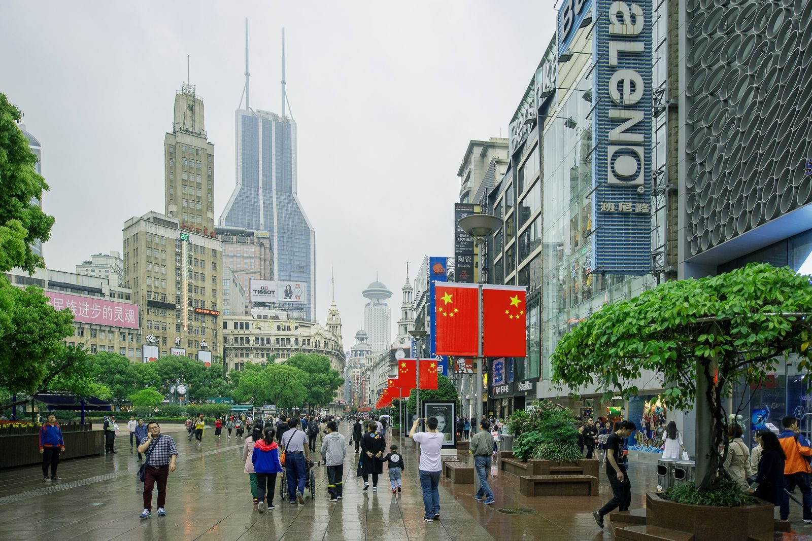
Getting there and staying: there is no metro station on the riverfront. East Nanjing Road station (Lines 2 and 10) is a 10-minute walk from the water; it closes to entry during National Day crowd surges. Hotels here are the most expensive in the city, from the Peace Hotel and the Waldorf Astoria on the Bund itself to the Renaissance Yu Garden a few blocks south. Mid-range travellers usually stay two stops away and walk. See hotels near the Bund for the full range.
People’s Square and Nanjing Road West
People’s Square was Shanghai’s racecourse until 1949; today it is the city’s civic centre and its busiest metro interchange (Lines 1, 2 and 8). Around the park sit the Shanghai Museum (until 14 November 2027 showing only a ticketed exhibition on the ancient Americas, from RMB 148, 9am–5pm, closed Mondays; the permanent galleries are at Shanghai Museum East in Pudong), the Shanghai Grand Theatre, and the Urban Planning Exhibition Hall with its scale model of the entire city, which is the single best way to understand the geography this article describes. Give the museum two hours and the planning hall one. The best museums in Shanghai ranks them against the newer Pudong branch.
West of the square, Nanjing Road West is a different street: luxury malls, office towers and, at the far end, Jing’an Temple. The restored Zhangyuan shikumen quarter, reopened in 2022 as a flagship-store village and now connected underground to the Nanjing Road West interchange (Lines 2, 12 and 13), is the most polished lane-house complex in the city and worth 45 minutes even if you buy nothing. People’s Square is the sensible base for anyone who wants to walk to the Bund, the Old City and Xintiandi and take one metro line to almost everywhere else; the trade-off is that the immediate streets feel corporate and the traffic is heavy.
The Old City: Yu Garden and Nanshi
South of the Bund, inside the ring of streets that follow the line of the demolished Ming city wall, is what remains of Chinese Shanghai before the treaty ports: the Old City (Nanshi, “southern city”). Its centrepiece is Yu Garden, a 1559 classical garden of rockeries, pavilions and carp ponds (¥40, 9am–4:30pm, last entry 4pm, closed Mondays except on public holidays, tickets sold in morning and afternoon sessions). Around it the Yuyuan Bazaar of Qing-style shopfronts sells everything from ¥15 fans to ¥1,500 tea sets, and the Nanxiang Steamed Bun Restaurant queue for xiaolongbao is a Shanghai tradition in itself. The City God Temple next door is a working Taoist temple with a small entry fee. Our Yu Garden guide covers the garden; Shanghai Old Town covers the lanes that surround it, which are disappearing block by block.
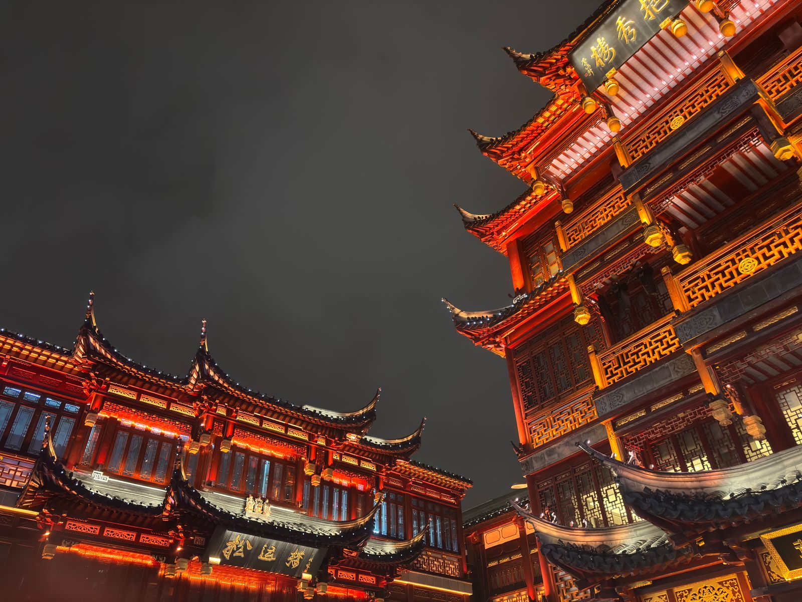
Timing matters more here than anywhere else in this Shanghai districts guide. Weekday mornings at opening are pleasant; Saturday afternoons are a crush; the annual Lantern Festival (February to early March) brings ticketed timed entry to the bazaar and crowds that make the lanes impassable. The bazaar shops stay open into the evening, when the lit roofs are at their best and the garden itself is closed. Yuyuan Garden station (Line 10, also Line 14) is a three-minute walk; the Bund is 15 to 20 minutes on foot along Zhongshan Road. Hotels are cheaper than on the Bund and the location is excellent, but the immediate area is loud and closes early apart from the bazaar.
The Former French Concession: Xintiandi, Tianzifang, Wukang Road
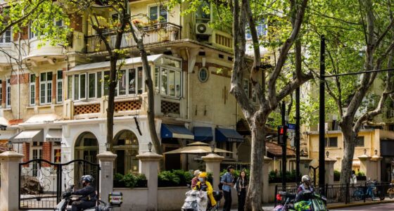
From 1849 to 1943 France administered a wedge of Shanghai that grew west from the Old City into what is now the most pleasant urban neighbourhood in China. The former French Concession (locals just say “the Concession” or “FFC”) is defined by its plane trees, planted by the French and now forming tunnels of green over streets like Wukang Road, Anfu Road, Hunan Road and Fuxing Road. Behind the trees are 1920s and 30s villas, Art Deco apartment blocks and shikumen lanes, most now holding cafés, restaurants, boutiques and consulates. It is a walking district, and the right way to see it is the route in our French Concession walking tour, which takes about three hours with coffee stops.
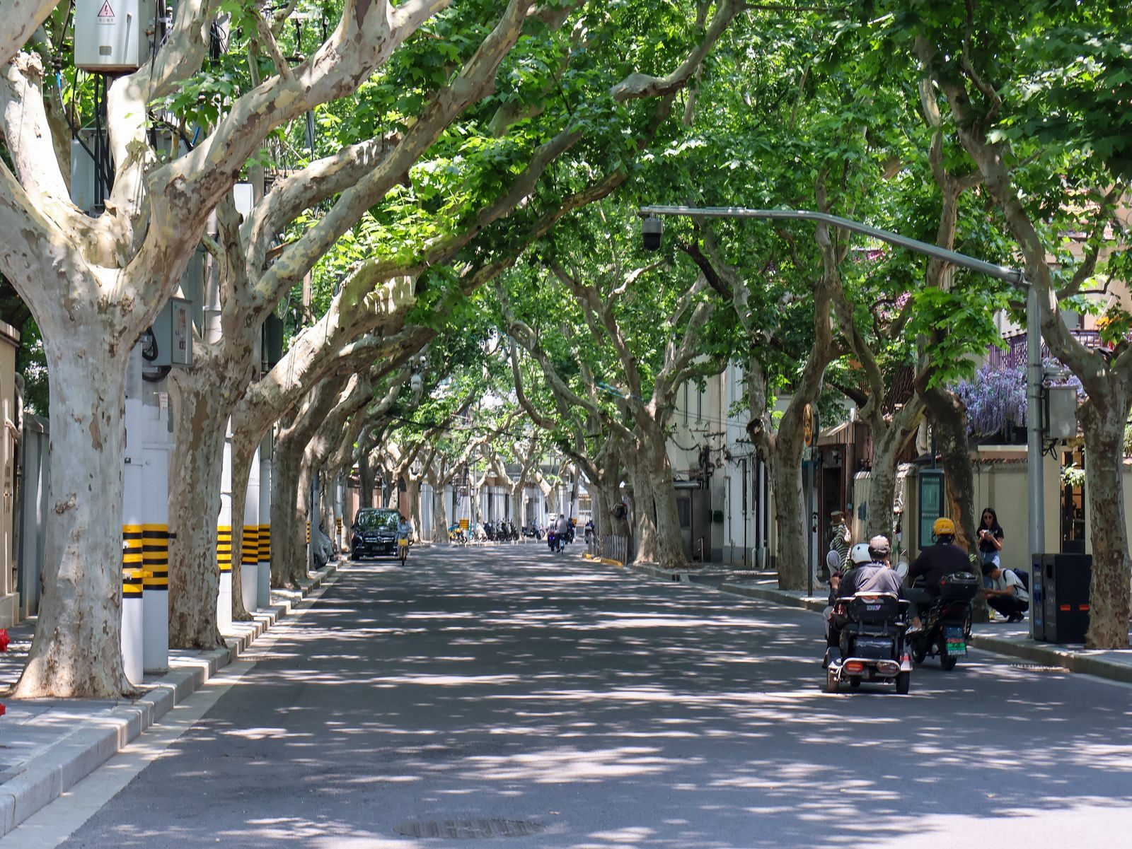
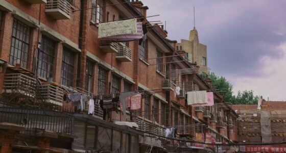
Three named pockets inside it get their own visitors. Xintiandi, at the eastern end, is a block of shikumen lane houses rebuilt in 2001 as an open-air dining and shopping quarter; it is expensive and slightly stage-set, but it is also where the Chinese Communist Party held its first congress in July 1921, and the museum on the site is free with a passport. Xintiandi station (Lines 10 and 13) sits underneath it. Tianzifang, a 15-minute walk south-west off Taikang Road (Dapuqiao station, Line 9, Exit 1), is the un-rebuilt version: a warren of still-inhabited lanes packed with craft stalls, tiny bars and photo studios, shops open roughly 10am to 9:30pm, and it is far better at 10am on a weekday than at 4pm on a Saturday. Wukang Road, at the western end near the Shanghai Library, is the show street: the 1924 Wukang Mansion flatiron at its foot is the most photographed building in Puxi, and the road north of it is lined with plaque-bearing heritage villas. Anfu Road, one block over, is where the city’s best independent cafés and bakeries cluster.
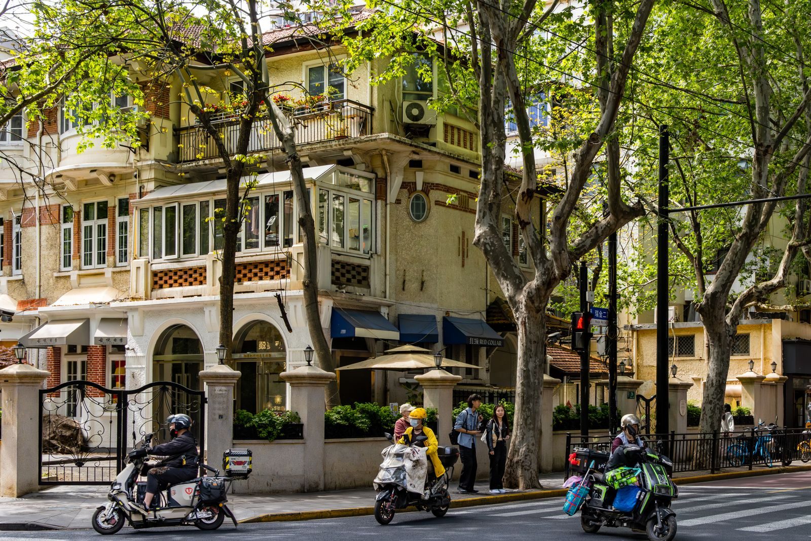
The catch is that the Concession is big (roughly 10 square kilometres) and has few tall landmarks, so it is easy to lose your bearings. Use Line 1 (Changshu Road, Shaanxi South Road), Line 10 (Xintiandi, Shanghai Library, Jiaotong University) and Line 7 (Changshu Road) to hop between pockets rather than walking end to end. Hotels range from boutique conversions of old villas to the Capella Jian Ye Li, which occupies an entire shikumen block (The Upper House Shanghai, renamed in October 2025, is over in Jing’an rather than here); see French Concession hotels. This is where most repeat visitors choose to stay, and where the best neighbourhoods for tourists comparison usually lands.
Jing’an: Temple, Malls and the Best-Connected Base
Jing’an is the district that swallowed Zhabei, but for visitors it means the square kilometre around Jing’an Temple, where a Buddhist temple with gold-leafed roofs sits in the middle of a mall-and-tower canyon at the western end of Nanjing Road West. The temple (¥50, 7:30am–5pm, last entry 4:30pm) traces its founding to 247 AD but the current buildings are mostly a 1990s–2010s rebuild in Song style; it takes 40 minutes, and the contrast of incense smoke against the Réel and Kerry Centre glass is the reason to go. Across the road, Jing’an Park is a shady former cemetery with an excellent teahouse, and five minutes north the free Jing’an Sculpture Park (6am–8:30pm) wraps around the Natural History Museum. Temples in Shanghai compares Jing’an with the quieter Jade Buddha and Longhua temples.
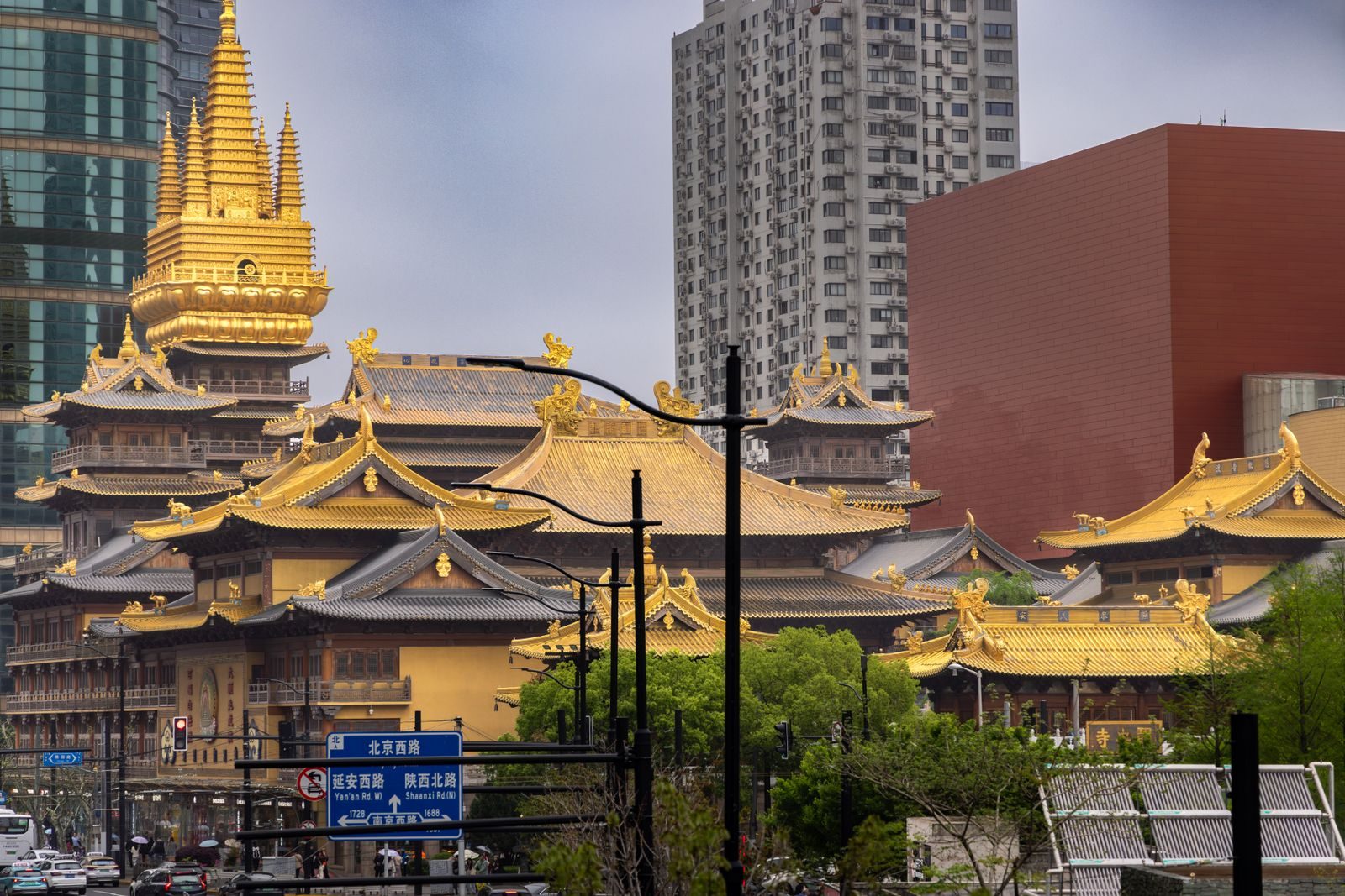
Why stay here: Jing’an Temple station is on Line 2 (four stops to Lujiazui, two to People’s Square, one line all the way to Pudong Airport) and Line 7, and the district has the densest cluster of international mid-range and upper hotels in the city, from the Puli and the Jing An Shangri-La down to reliable chains at ¥400–600. Wujiang Road behind the Kerry Centre is a solid cheap-eats street. What you give up is atmosphere: the streets are wide and commercial, and the charm of the Concession begins a 15-minute walk south. For many travellers that trade is worth it.
Lujiazui and Pudong: The Skyline Side of the River
Cross the river and the century changes. Lujiazui is the financial district on the bend of the Huangpu directly opposite the Bund, and it holds the four towers in every skyline photo: the Oriental Pearl (1994, the one with the spheres), Jin Mao (1999), the bottle-opener Shanghai World Financial Center (2008) and the 632-metre Shanghai Tower (2015), whose 118th-floor deck (¥180, 8:30am–10pm) is the highest observation point in China. The SWFC observatory has been closed since 2023 with no confirmed reopening; do not plan around it. Our Shanghai Tower guide and best views in Shanghai cover which deck is worth the ticket. The riverside Binjiang promenade at the foot of the towers is free and gives the reverse view back across to the Bund; the elevated circular walkway at Lujiazui station is the easiest way to photograph all four towers at once.
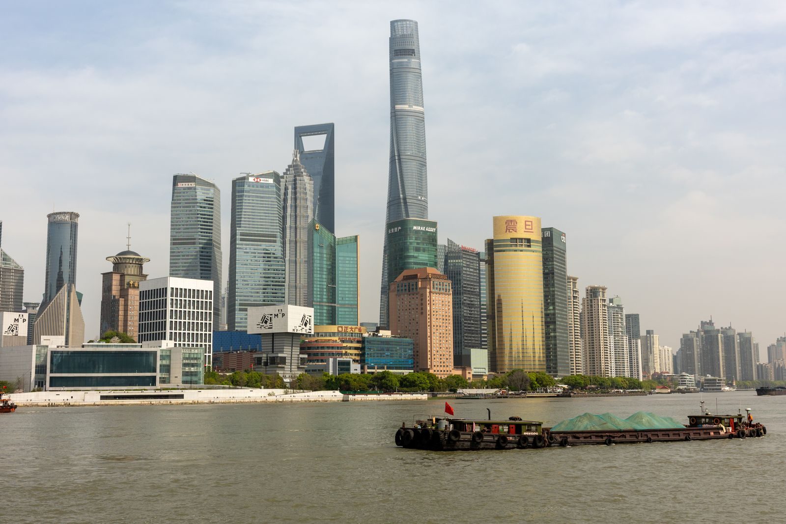
Pudong has grown up beyond the towers. Two stops east on Line 2, Century Park is a 140-hectare park that has been free and open 24 hours since 2024, and next to it the Shanghai Museum East (free, no reservation, 10am–6pm, closed Tuesdays) has become the city’s flagship museum with the bronzes and ceramics that used to live at People’s Square. The Science and Technology Museum, rebuilt and reopened in February 2026, is on the same stretch. Further south, Qiantan (New Bund) is a riverside business quarter with the open-air Taikoo Li mall, and far to the south-east lie the airport and Disneyland. Pudong is the family base: hotels are big, rooms are large, the pavements are wide, and the Ritz-Carlton, Park Hyatt and Grand Hyatt all have skyline rooms. The downside is that Lujiazui empties after 8pm and the walk between any two points is longer than it looks on the map.
Hongkou and the North Bund
North of Suzhou Creek, across the 1907 Waibaidu iron bridge at the top of the Bund, is Hongkou: the old American and then Japanese settlement, and today the most under-visited central district. Its riverfront, the North Bund, is being rebuilt as a third business district (a 480-metre tower, Puxi’s tallest, is due around 2030) but the promenade is already open and gives a wider, quieter angle on the Lujiazui skyline than the Bund itself. Inland, the Tilanqiao quarter is where roughly 20,000 European Jewish refugees lived during the Second World War; the Shanghai Jewish Refugees Museum in the former Ohel Moshe Synagogue (62 Changyang Road, Tilanqiao station on Line 12) tells the story well and is the district’s one essential stop.
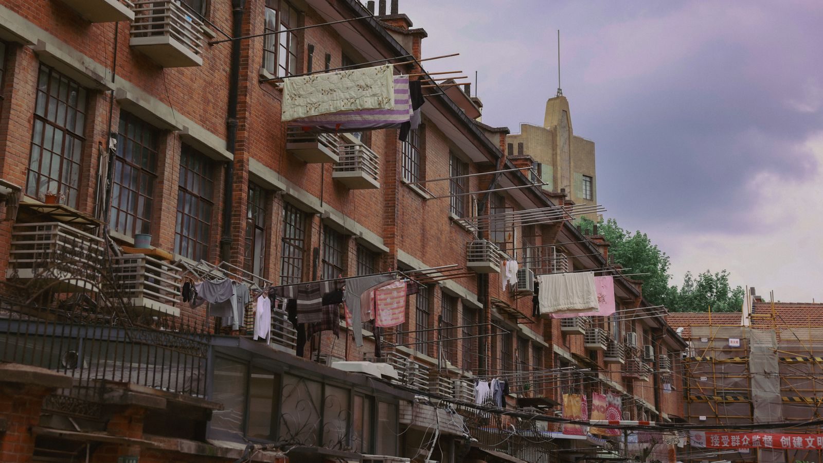
Two more stops reward the curious. Duolun Road (Dongbaoxing Road, Line 3) is a 550-metre pedestrian street of 1920s villas where Lu Xun and the left-wing writers of the 1930s lived, with a small modern art museum and old-fashioned teahouses. 1933 Old Millfun (Hailun Road, Line 4/10) is a 1933 Art Deco slaughterhouse of concrete ramps and bridges, now holding restaurants and event spaces and free to wander. Hotels in Hongkou are cheaper than anything south of the creek, and the district has a genuinely local feel, but the sights are scattered and English signage thins out fast. It suits a second visit, or a half-day from a Bund base.
Xuhui and the West Bund Museum Mile
Follow the Huangpu south from the Concession and the riverbank becomes the West Bund, 11 kilometres of former docks, cement works and an aircraft factory turned into parkland, running tracks and the city’s contemporary-art quarter. The Long Museum West Bund, Tank Shanghai (galleries inside five former aviation-fuel tanks) and the West Bund Museum, whose five-year partnership with the Centre Pompidou has been renewed with exhibitions running into late 2026, sit within a two-kilometre stretch. Expect ¥50–200 per exhibition and hours of roughly 10am to 6pm with Monday closures; check each venue before you go. The contemporary art guide ranks them, and the art scene guide covers the smaller galleries.
The practical problem is distance. The nearest stations (Yunjin Road on Line 11, Longhua on Line 11/12) are a 15-minute walk from the river, and the venues are spread out, so the West Bund works best on a shared bike along the riverside path, with Longhua Temple and its pagoda as a bonus at the southern end. There are almost no hotels; base yourself in the Concession, 20 minutes north.
Suzhou Creek, M50 and Putuo
Suzhou Creek is the muddy tributary that joins the Huangpu at the Bund and divides Huangpu from Hongkou. Its banks have been turned into a continuous walkway from Waibaidu Bridge westward past the old Post Office, warehouses and the Shanghai Railway Station towards Putuo, and the core 12-kilometre stretch is now a pleasant if unglamorous walk. The reason most visitors come is M50 at 50 Moganshan Road (Jiangning Road station, Line 13, then ten minutes on foot): a textile-mill compound holding well over a hundred galleries and studios, free to enter, most open from about 10am, with the city’s best sanctioned street art on the surrounding walls. Two to three hours is enough. Putuo has little else for visitors, and the hotels near Shanghai Railway Station are budget options rather than a destination; see budget hotels and hostels if the price appeals.
Outer Shanghai: Hongqiao, Qibao, Zhujiajiao, Songjiang and Disneyland
Beyond the Middle Ring the map breaks into a handful of specific reasons to travel. Hongqiao, on the western edge of Changning, is the transport hub: Hongqiao Railway Station (China’s busiest high-speed terminal) and Hongqiao Airport share one complex on Lines 2, 10 and 17, and the Airport Link Line, opened in December 2024, now runs from here to Pudong Airport in about 40 minutes. The neighbouring Gubei area is the long-standing Japanese and Korean expat quarter, which makes it the best place in Shanghai for ramen and Korean barbecue but otherwise nothing to see. Stay here only if you are catching an early train; the Hongqiao airport guide explains the layout.
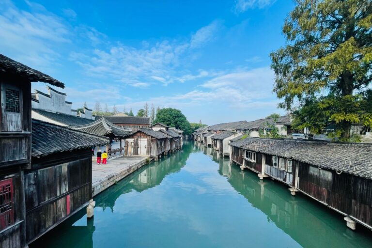
Qibao (Line 9, 35–40 minutes from People’s Square) is a thousand-year-old canal town swallowed by Minhang’s suburbs: one main street of snack stalls (fermented tofu, sticky-rice cakes, sugar-coated haws), a couple of bridges, a shadow-puppet theatre and a temple, free to walk, with small ticketed attractions from 9am to 6pm. Arrive by 10am or after 4:30pm when the lanterns come on; at weekend midday it is packed. Zhujiajiao in Qingpu (Line 17, 70–80 minutes from People’s Square with a change at Hongqiao, or 40 minutes from Hongqiao itself) is the proper article: 36 stone bridges, working canals, boat rides and a combined attraction ticket of ¥40–80 while the town itself is free. It deserves most of a day; our Zhujiajiao guide and the wider day trips from Shanghai pillar compare it with Tongli, Wuzhen and Zhouzhuang.
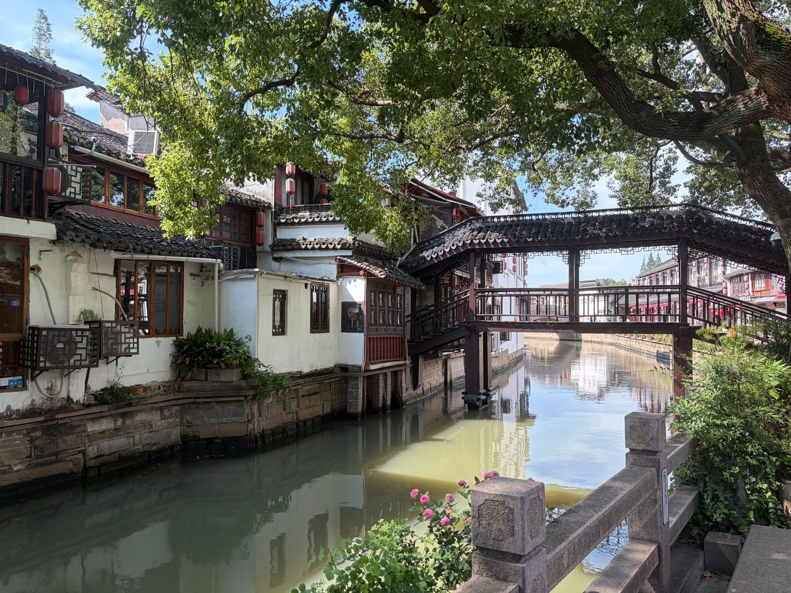
Songjiang, south-west on Line 9, has two curiosities: Sheshan, a pair of wooded hills topped by a 1935 Catholic basilica and an observatory, and Thames Town, a 2006 replica English village of cobbles, pubs and a church, now mostly a wedding-photo backdrop. Both need a bus or taxi from the metro and together fill a half day. Disneyland sits at the end of Line 11 in Chuansha, south-east Pudong, 50–60 minutes from the centre, with its own hotels and the free Disneytown dining strip; it is a destination in itself and a poor base for anything else, as our Disneyland guide explains. Finally, Legoland Shanghai opened in July 2025 at Fengjing in Jinshan District, well over an hour south-west of the centre by car or coach, and Chongming Island to the north is the city’s rural district of wetlands and cycle paths, reached by bus over the Yangtze bridge and, once Line 22 opens, by metro.
Getting Between Shanghai Districts: Metro, Ferry and Tunnel
The metro handles nearly every journey in this guide, and the two east–west lines matter most. Line 2 runs Hongqiao Airport – Jing’an Temple – Nanjing Road West – People’s Square – East Nanjing Road – Lujiazui – Century Park – Pudong Airport. Line 10 runs Hongqiao Railway Station – Jiaotong University – Shanghai Library – Xintiandi – Yuyuan Garden – East Nanjing Road – Hongkou. Line 1 serves the Concession’s Changshu Road and Shaanxi South Road and People’s Square; Line 9 goes to Tianzifang, Qibao and Songjiang; Line 11 to Disneyland; Line 17 to Zhujiajiao. A single fare is ¥3–15 by distance, a one-day pass is ¥18 and a three-day pass ¥45 (sold at ticket counters, not valid on the Maglev; details on the Shanghai Metro site). Trains run from about 5:30am to between 10:30pm and 11:30pm depending on the line, so a late night on the Bund usually ends in a taxi; using DiDi covers ride-hailing and taxi tips the fallback.
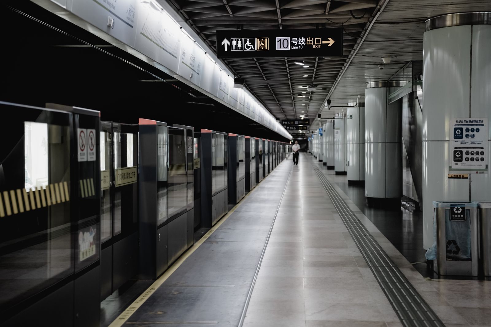
Crossing the river between the Bund and Lujiazui has three options. The metro (East Nanjing Road to Lujiazui, one stop on Line 2) is fastest door to door. The Bund Sightseeing Tunnel beneath the river is a five-minute capsule ride through a light show, about ¥50 one way, open until roughly 10:30pm, and is a novelty rather than transport. The best value is the public ferry from the Jinling Road East pier at the south end of the Bund to Dongchang Road in Pudong: ¥2 by transport card or QR code, every 10 to 15 minutes, with a five-minute crossing that gives you the skyline from the water for less than the price of a bottle of water. Sources disagree on whether the last sailing is around 6:30pm or later in the evening, so treat it as a daytime crossing and check the pier board. If you have the budget, the Huangpu night cruise is the same view with dinner and an hour on the water.
Metro times between key districts
| From → To | Line(s) | Typical time |
|---|---|---|
| East Nanjing Road (Bund) → Lujiazui | Line 2 | 5 min |
| East Nanjing Road → People’s Square | Line 2 or 10 | 3–5 min |
| East Nanjing Road → Jing’an Temple | Line 2 | 10–12 min |
| East Nanjing Road → Xintiandi | Line 10 | 8–10 min |
| East Nanjing Road → Shanghai Library (Wukang Rd) | Line 10 | 15–18 min |
| People’s Square → Tianzifang (Dapuqiao) | Line 8 → Line 9 at Lujiabang Rd | 15–20 min |
| People’s Square → Shanghai Museum East (Century Park) | Line 2 | 15–20 min |
| People’s Square → Qibao | Line 1 → Line 9 at Xujiahui | 35–40 min |
| People’s Square → Zhujiajiao | Line 2 → Line 17 at Hongqiao Railway Station | 70–80 min |
| People’s Square → Disney Resort | Line 8 → Line 11 at Oriental Sports Center | 50–60 min |
| Jing’an Temple → Pudong Airport | Line 2 (change at Guanglan Rd on some trains) | 75–85 min |
Which District Should You Stay In?
The honest answer for a first visit of three to five days is anywhere inside the triangle formed by the Bund, Jing’an Temple and Xintiandi: that puts you within a 25-minute walk or a ten-minute metro ride of nearly everything in this guide. Within that triangle, choose by temperament. The Bund and People’s Square if you want to step out of the hotel into the postcard and do not mind paying for it or sharing it. Jing’an if you want the most hotel choice and the easiest airport run. The Concession if you want to spend evenings walking under trees to a restaurant rather than taking a taxi to one. Lujiazui if you are travelling with children, want a big room with a skyline view, or are combining the city with Disneyland.
Stay elsewhere only with a reason. Hongkou and the Old City are good value if the budget is tight and you are happy to be a metro stop from the action. Hongqiao makes sense for a single night before a high-speed train. Zhujiajiao makes a lovely overnight if you want the canals to yourself after the tour buses leave at 5pm. Nothing else in the outer districts justifies a hotel. For the ranked version with named hotels at each price, read best neighbourhoods in Shanghai for tourists; for what a stay will cost in total, how much a Shanghai trip costs.
A District-by-District Plan for Three Days
Because the districts cluster, the efficient way to plan is one bank or one corridor per day. Day one: Huangpu. Yu Garden at 9am opening, the Old City lanes, lunch at the bazaar, walk north to the Bund by 2pm for the architecture, Yuanmingyuan Road, then Nanjing Road East to People’s Square and the Urban Planning Exhibition Hall before it closes. Back to the Bund for the lights at 7pm. Day two: the Concession and Jing’an. Coffee on Anfu Road, the Wukang Road walk, metro to Xintiandi for the Congress museum and lunch, Tianzifang in the early afternoon while it is still bearable, then Line 2 to Jing’an Temple for the late-afternoon light on the gold roofs and dinner on Wujiang Road. Day three: Pudong. Shanghai Museum East at 10am, Century Park, Line 2 back to Lujiazui for the Shanghai Tower deck around 4pm so you see daylight, dusk and the lights from the top, then the ¥2 ferry (if it is still running) or the metro back to the Bund for a rooftop bar. Our 3-day Shanghai itinerary turns this into an hour-by-hour plan, and the itinerary hub has versions from one day to ten.
Mistakes First-Timers Make With Shanghai’s Geography
Booking a hotel “in Pudong” because it is cheap. Pudong is 1,200 square kilometres. A bargain near the airport or in Zhoupu is an hour from Lujiazui, let alone the Bund. Check the metro station, not the district name. Assuming the French Concession is one place. Xintiandi and Wukang Road are 3.5 kilometres apart; plan the Concession as three or four pockets connected by metro. Arriving at the Bund at 10pm for the lights. They go off at ten. Doing Yu Garden on a Saturday afternoon. Go at 9am on a weekday, or skip the garden and see the bazaar after dark. Treating Zhujiajiao and Qibao as interchangeable. Qibao is a 40-minute metro ride and a two-hour stop; Zhujiajiao is a day. Planning around the SWFC observatory. It has been closed since 2023. Underestimating walking distances in Pudong. Lujiazui station to the Shanghai Tower entrance looks adjacent on the map and is a 15-minute walk around building podiums; the elevated walkway helps. And ignoring Hongkou, which is ten minutes from the Bund and where the crowds are not. More of these in first time in Shanghai and practical tips.
Frequently Asked Questions
How many districts does Shanghai have?
Sixteen. Seven are the central Puxi districts (Huangpu, Xuhui, Changning, Jing’an, Putuo, Hongkou, Yangpu), one is Pudong New Area on the east bank, and eight are suburban or rural (Minhang, Baoshan, Jiading, Songjiang, Jinshan, Qingpu, Fengxian and Chongming). Older maps show 19 because Zhabei, Luwan and Nanshi have since been merged into their neighbours.
What is the difference between Puxi and Pudong?
Puxi is the west bank of the Huangpu and the historic city: the Bund, the Old City, the former concessions, most restaurants and nightlife. Pudong is the east bank, developed since 1990, with the skyscrapers, the international airport, Disneyland and the new Shanghai Museum East. A metro ride between the two central cores takes five minutes; door to door between a Puxi hotel and a Pudong one is usually 30–45 minutes.
Which district is the Bund in?
Huangpu District, which also contains Nanjing Road East, People’s Square, the Old City and Xintiandi. If you search hotels by district, “Huangpu” is the one that means “central”.
Is Pudong or Puxi better for tourists?
Puxi for most people: it has the walkable neighbourhoods, the history and the food. Pudong wins for families who want space, for anyone prioritising a skyline-view room, and for trips built around Disneyland. Many visitors stay in Puxi and spend one day in Pudong.
Which Shanghai districts are the most walkable?
The former French Concession (especially around Wukang Road, Anfu Road and Fuxing Road), Xintiandi and Tianzifang, the Bund-to-People’s Square corridor along Nanjing Road East, and the Old City lanes. Jing’an is walkable but less pleasant; Lujiazui has wide roads and long distances between buildings.
What is the most expensive district in Shanghai?
By property price, central Jing’an, Huangpu and Xuhui trade places at the top, with prime Concession villas and Bund-facing apartments the most expensive addresses in mainland China. For hotels, the Bund riverfront and Lujiazui’s tower hotels are the priciest, and the French Concession’s boutique conversions are not far behind.
Where do expats live in Shanghai?
Traditionally the former French Concession and Jing’an for singles and couples, Gubei and Hongqiao in Changning for Japanese, Korean and Taiwanese families near the international schools, and Jinqiao in Pudong for Western families in compound housing. None of these are sights in themselves, but the Concession’s expat density is why its café and restaurant scene is so strong.
How do I get from the Bund to Pudong?
Metro Line 2 from East Nanjing Road to Lujiazui is one stop. The ¥2 public ferry from Jinling Road East pier to Dongchang Road takes five minutes and gives the best view. The Bund Sightseeing Tunnel (about ¥50) is a light-show ride rather than a practical crossing. There is no pedestrian bridge.
Is Qibao or Zhujiajiao the better water town?
Zhujiajiao, if you have the day: it is larger, has real working canals and boat rides, and is worth the 70–80 minute trip on Line 17. Qibao is a two-hour stop on Line 9 that gives a taste of the canal-town look plus a good snack street. If you are going on to Suzhou, Tongli or Wuzhen anyway, you can skip both.
How long does it take to get from Hongqiao to the Bund?
About 35–45 minutes on Line 2 from Hongqiao Railway Station or Airport Terminal 2 to East Nanjing Road, or 25–40 minutes by taxi depending on traffic (¥70–100). From Pudong Airport it is 60–75 minutes on Line 2, or roughly 45 minutes by taxi (¥170–220).
Do I need a Shanghai metro day pass?
Only if you will make more than five or six rides in a day; single fares are ¥3–7 for most central journeys. The ¥18 one-day and ¥45 three-day passes are sold at station counters and do not cover the Maglev. Most visitors simply tap a contactless bank card or scan Alipay.
Which district is best for nightlife?
The former French Concession for cocktail bars and restaurants, the Bund for rooftop bars with the view, and Xintiandi for a polished late evening. Jing’an has the clubs. Lujiazui has a few hotel bars and little else after dark. See the Shanghai nightlife guide.
Shanghai rewards visitors who think in districts. Pick a base inside the Inner Ring, give each corridor its own day, use Lines 2 and 10 as your spine, and cross the river at least once by water. The rest of this site fills in the detail: the complete Shanghai travel guide for the big picture, things to do in Shanghai for the attractions inside each district, and getting around Shanghai for the transport that links them.
Explore Shanghai District by District
Keep planning with our in-depth companion guides:
- Tianzifang Guide: Shopping, Cafes & How to Beat the Crowds (2026) — Three narrow lanes off Taikang Road, roofed in washing lines and air-conditioning units, packed with shops selling cat-shaped fridge magnets…